About Aspen Orientation
(Aspen, Colorado - CO, USA)
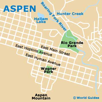
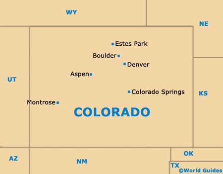
Famed for its ski resorts and mountainous scenery, the city of Aspen is actually the county seat, standing in Pitkin County, on the southern side of Colorado. Central Aspen is fairly small and compact, being easy to walk around and navigate on foot.
Aspen Orientation: Layout and Directions
Aspen's main axis runs diagonally, from the southeastern side of the city to the northwestern region, where Colorado Highway E-82 meets East Cooper Street, which leads to Aspen / Pitkin County Airport (ASE) along East Airport Road. The city center is bounded by Hopkins Avenue on the northern side and Durant Avenue to the south - known for its high concentration of hotels and places of eat.
Locals in Aspen / Pitkin County Airport (ASE) often refer to the mountain ski resort as 'Ajax'. Standing of the southeastern side of Aspen, this ski resort is easily reached and a particularly lively area. From the western side of Aspen you are able to head south and reach a number of truly exceptional ski slopes, such as Ashcroft, the Aspen Highlands and the Snowmass Nordic, while Buttermilk on the northwestern side of Aspen is perhaps the most famous of its ski resorts.
Orientation and Map of the USA

Orientation and State Map of Colorado
Orientation and Map of Aspen